Dr Kimberley Reid provides an explainer of the climatic phenomenon known as El Niño.
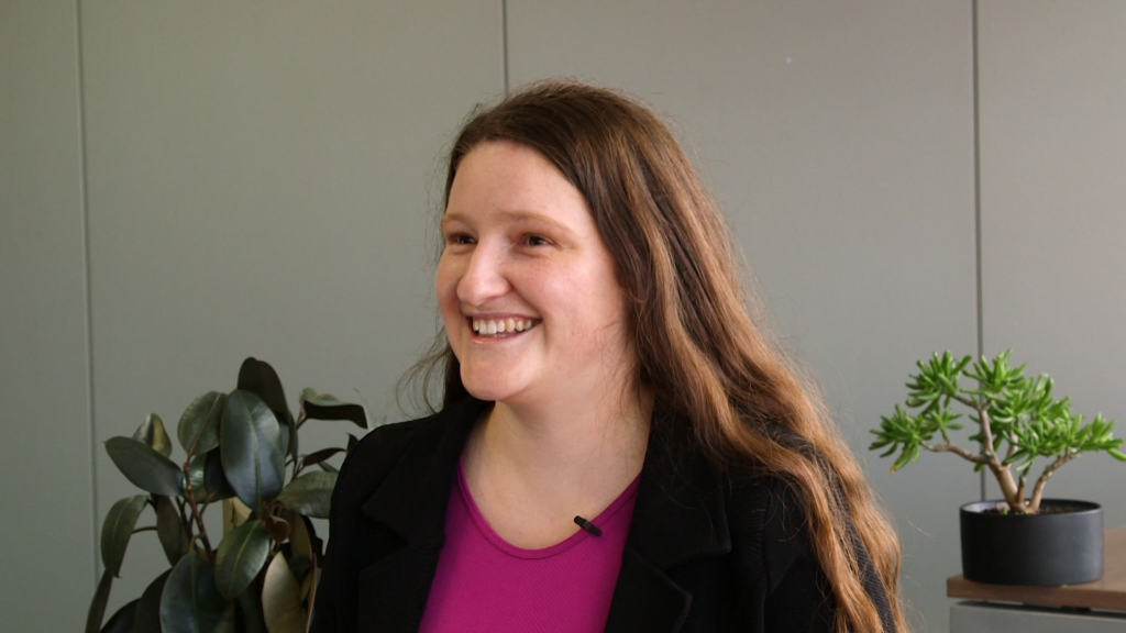 Dr Kimberley Reid, from ARC Centre of Excellence for Climate Extremes, Monash University, explains El Niño : Michael Joiner, 360info CC BY 4.0
Dr Kimberley Reid provides an explainer of the climatic phenomenon known as El Niño.
Dr Kimberley Reid from Monash University explains El Niño, the impacts it has in the Asia-Pacific region, how scientists predict it, and how it’s being affected by climate change.
Download audio version of interview:
Download raw version of interview:
Transcript
Quotes attributed to Dr Kimberley Reid, ARC Centre of Excellence for Climate Extremes, Monash University
“So El Niño, and the flip side La Niña, is collectively known as ENSO or the El Niño-Southern Oscillation, and it’s this coupled phenomena between the atmosphere and ocean.”
“So what that means is the atmosphere and ocean are talking to each other and influencing the weather around the globe. And it’s one of the biggest influences of weather patterns globally.”
“The Bureau of Meteorology won’t actually declare an El Niño year unless they see a signal in both the ocean and the atmosphere.”
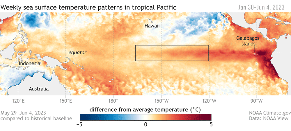
“During El Niño, there’s typically warmer ocean temperatures over near South America and cooler ocean temperatures near Australia. And what this does is it weakens the winds that move from east to west across the equator.”
“And this weakening of the winds sort of pushes this region of lots of rainfall and convection that’s typically near Australia out towards the middle of the Pacific. And that’s why in Australia, El Niño is typically associated with warmer than average and drier than average weather conditions.”
“Places in Asia also typically get hotter weather as we’ve seen in the last few months with strong heatwaves over Asia.”
“The funny thing about El Niño is that it was actually discovered by Peruvian fishermen hundreds of years ago because they noticed that the warm ocean temperatures off the coast of South America was impacting their fishing.”
“And so because there’s less cold upwelling from the deep ocean and less nutrients rising to the surface, they actually would catch fewer fish. So it can have far-ranging impacts not just on the weather but on aquaculture as well.”
“So scientists use what we call subseasonal-to-seasonal forecast models to try and predict El Niño events. And so these models are really looking at this time period from two weeks to nine months, which is quite a murky area.
“It’s very difficult to forecast that far in advance because the atmosphere is what we call very chaotic.”
“We can’t really forecast the atmosphere that far in advance but we can have an idea about what the ocean’s doing that far in advance.”
“So that’s why there’s a lot of emphasis on the sea surface temperatures and what we call this Nino 3.4 region. So that’s a box over in the middle Pacific where scientists look at whether the ocean temperatures are at a level above or below average. And once they’re above about 0.5 degrees [Celsius], if you’re the US NOAA, or if they’re about point eight [degrees Celsius] if you’re the Bureau, that’s when they consider this to be an El Niño.”
“Climate change is impacting the baseline. So when we just define an El Niño, we’re looking at temperature anomalies.”
“Because the ocean is hotter generally in order to get a 0.5 [degrees Celsius] temperature anomaly, we actually need more heat than we previously did.”
“And so there’s a lot of debate going on about whether we need to redefine our El Niño definitions to take into account climate change.”
Dr Kimberley Reid is a postdoctoral researcher with the ARC Centre of Excellence for Climate Extremes, based at Monash University. Her research focuses on understanding extreme rainfall, climate change impacts on rainfall patterns, and evaluating the devastating east coast floods of 2022.
Originally published under Creative Commons by 360info™.


