For all flood-prone cities of India, there is an urgent need to develop flood inundation maps.
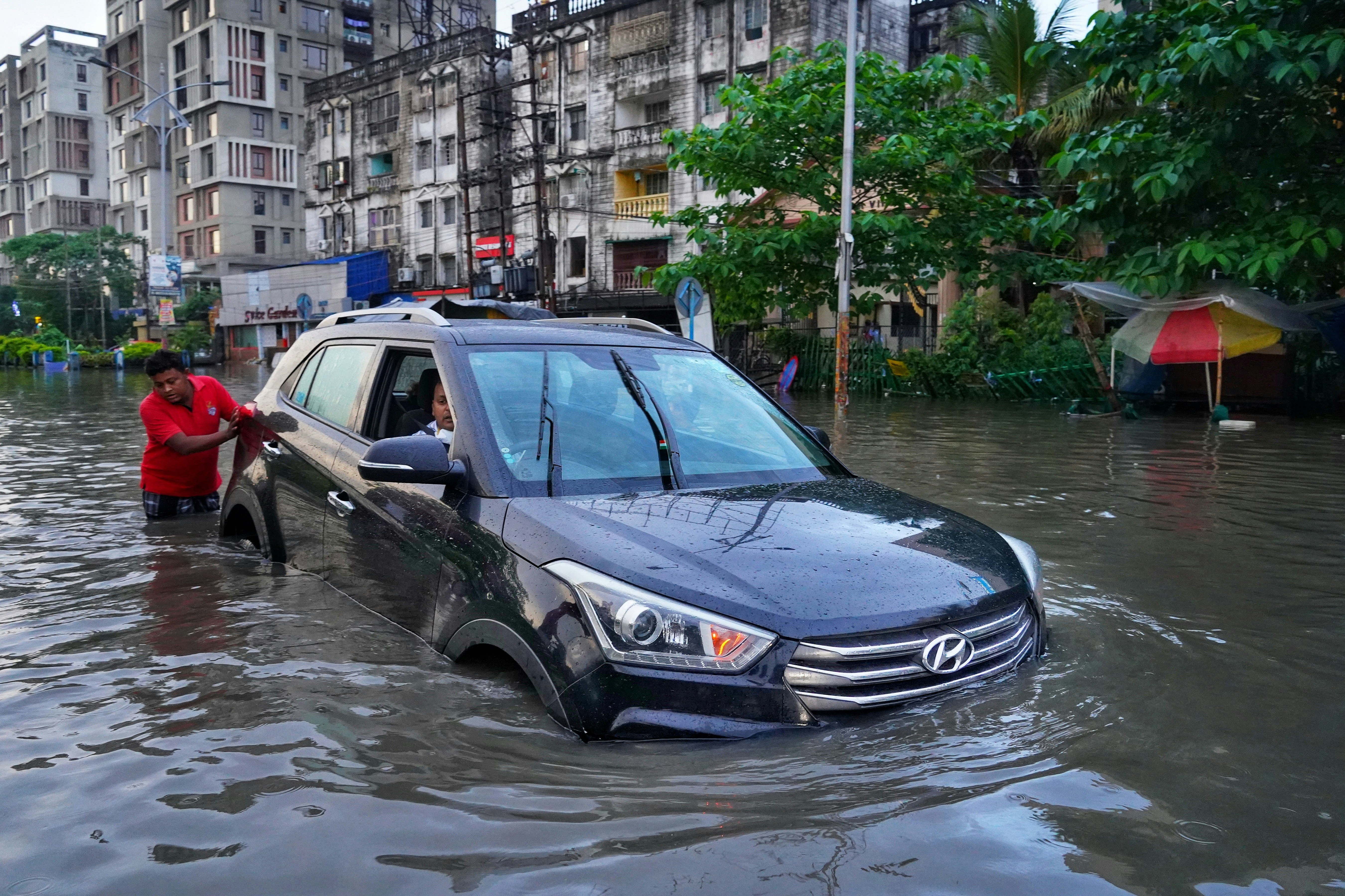
 Mumbai’s floods are becoming more frequent and result in large-scale disruption. : Dibakar Roy via Unsplash – https://tinyurl.com/bpa74z82 Unsplash Licence
For all flood-prone cities of India, there is an urgent need to develop flood inundation maps.
Although Bollywood films are full of songs romancing the rains, the southwest monsoon brings massive disruption to the residents of Mumbai, which houses Bollywood.
Although the metropolis has been expanding at a fast pace, because of its coastal location and prevalence of creeks, it is prone to flooding during monsoon rains this time of the year.
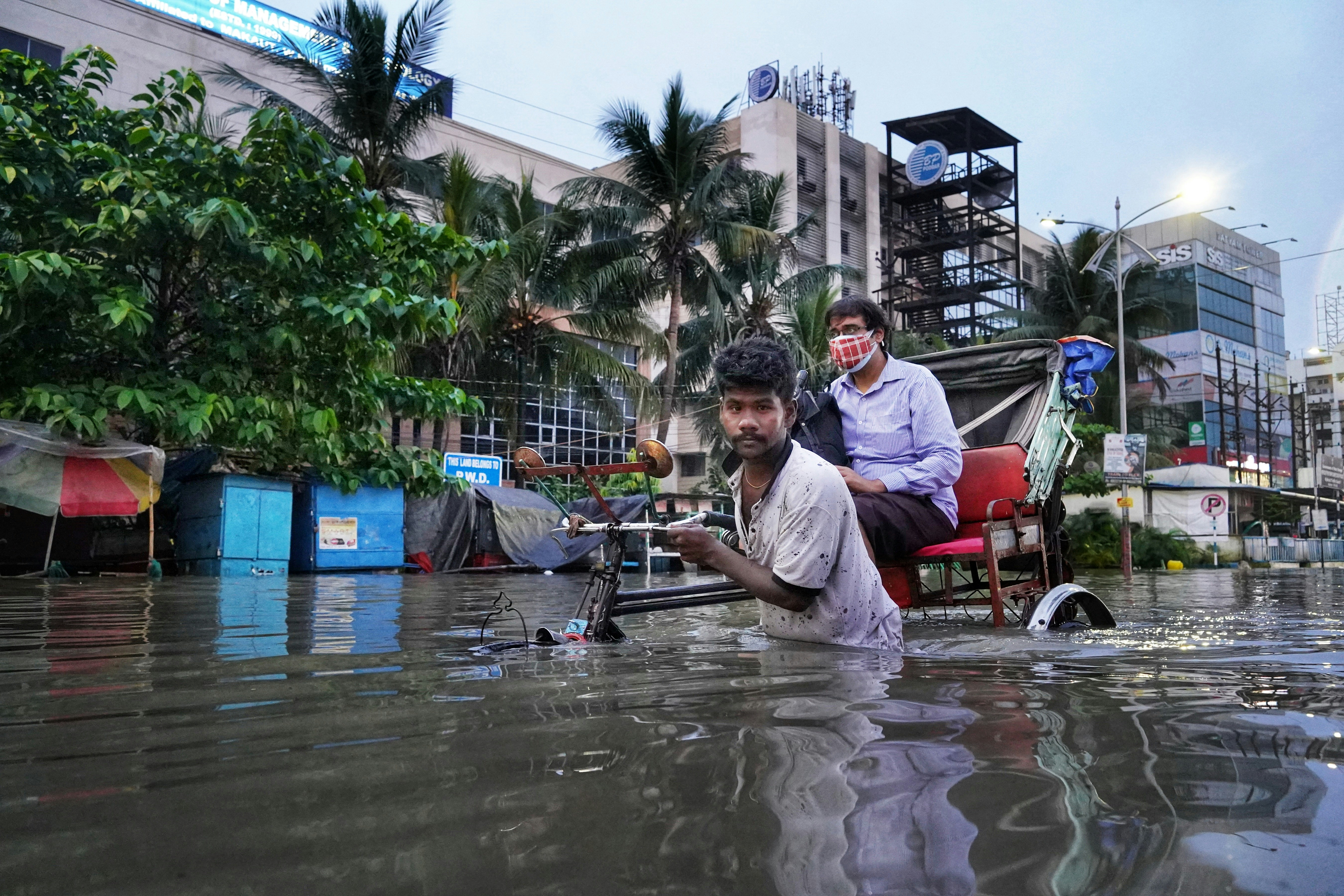
The city gets flooded almost every year. In the past decade, there have been four notable years for flooding in 2015, 2017, 2019 and 2023.
Mumbai’s floods result in large-scale disruption, crippling transport links and leading to loss of livelihood besides destroying infrastructure, property and causing massive injuries.
While Mumbai suffers during the southwest monsoon, Chennai, the capital of Tamil Nadu state, on the southeast coast, is flooded during the northeast monsoons and cyclonic storms in November and December.
Since the 2004 tsunami, there have been 14 cyclonic storms which have led to regular flooding in the area. Recent flood occurrences in Chennai are similar to that of Mumbai (2015, 2017, 2021 and 2023). This suggests that the factors influencing flooding in these two cities are pretty much the same.
Mumbai and Chennai are not the only Indian metros prone to flooding.
New Delhi, Bengaluru, Kolkata and Thiruvananthapuram, all developed on the banks of rivers, are also prone to flooding. The natural terrain of these cities is being changed because of their incessant expansion, leading to the construction of buildings and infrastructure which increases the proportion of impervious surface.
Flooding of coastal cities is expected to be more frequent in the 21st century than in the previous centuries. This can be attributed to climate change, population growth, and the absence of fit-for-the-purpose town planning.
Due to climate change, we will be encountering more water when we don’t need it and we will not have water when we desperately need it.
A warmer climate, the expansion of urban areas, the impact of urbanisation on the water environment and changes in rainfall characteristics can often impact the stormwater drainage in the cities and as a result, the mitigation of flood damage. In Mumbai, for example, it has been estimated that by 2080, due to climate change, the flood magnitude may be double that of the 2005 flood event.
Another factor that influences flooding is the average elevation of the urban area above the mean sea level. This is particularly important for coastal cities like Mumbai and Chennai. The average elevation for these two cities is under 15 metres.
In comparison, cities in Australia such as Sydney, Perth and Adelaide are more than 50m.
This helps explain the frequent flooding experienced by Mumbai and Chennai, particularly during monsoon periods.
Nevertheless, there are several factors which contribute to the flooding in urban areas. These factors can be summarised as shown below.
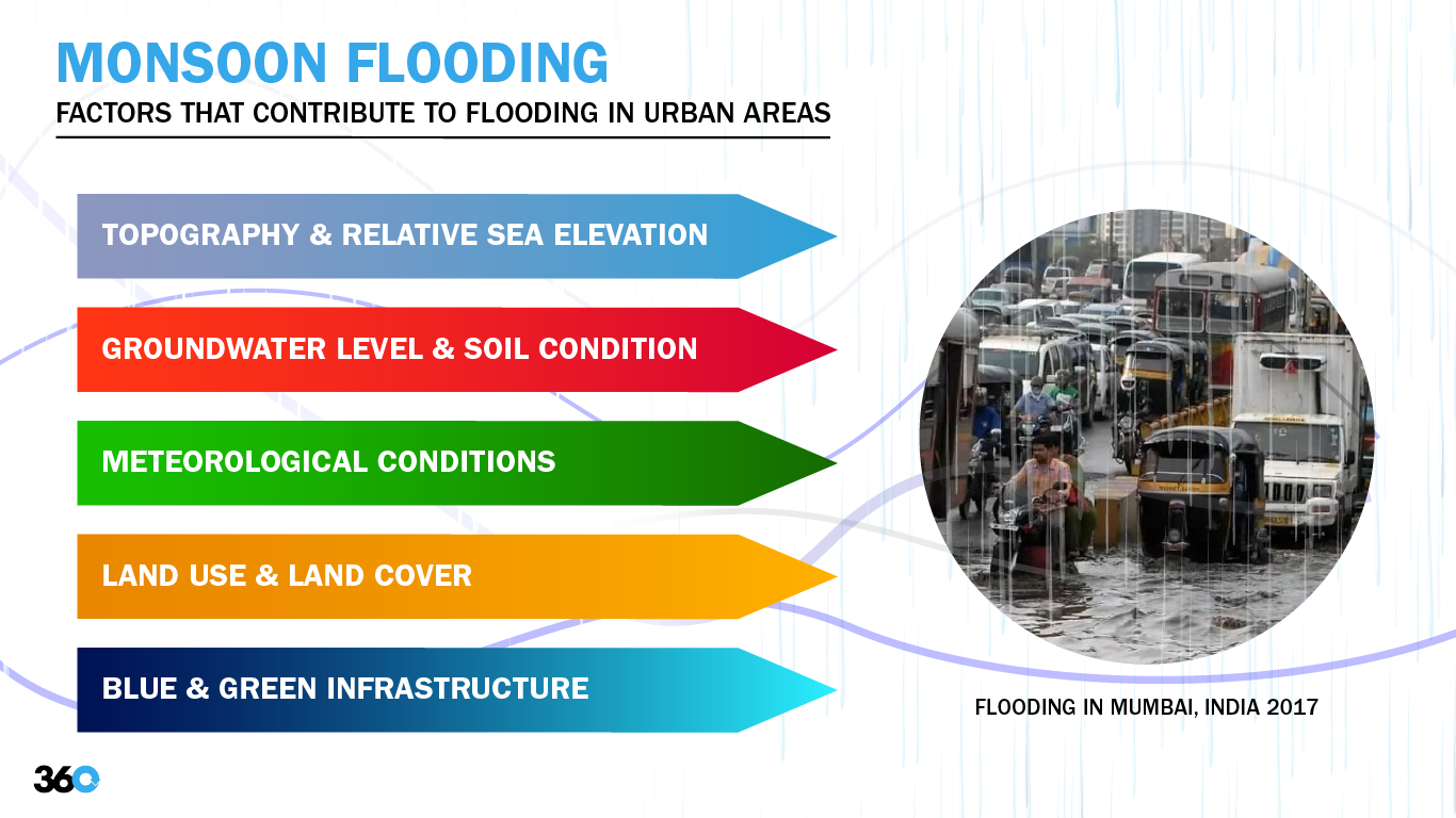
Cultural, social, political, economic, cultural and technological factors can affect flooding in Chennai and Mumbai although relentless rain and cyclones during monsoon periods appear to be the main cause.
This is compounded by the encroachment of waterways, lakes and mangroves (in the case of Mumbai) by an expanding population. Another factor is the waste disposal in the stormwater drains, which results in blockages.
Given the frequent flooding of Indian cities, mitigation measures are needed.
Relocation of a part or an entire city to a higher elevation is actively considered in many countries, such as Indonesia’s capital, Jakarta, or Lismore and Grantham in Australia. This could be the only option for many cities due to the erratic rainfall pattern owing to changes in the climate.
Indeed, India could learn much from Australia’s flood preparedness.
India’s cities urgently need 1-in10 and 1-in-100 year flood inundation maps, which can be generated by using appropriate data and modelling tools. In Australia, the Bureau of Meteorology is the main custodian of weather data generated by stations across the country.
The Australian government and Engineers Australia recently commissioned the development of the Australian Rainfall and Runoff handbook. This online tool allows for immediate updates whenever new data or models are available. A similar handbook would be a valuable tool for India.
Australian city councils are at the forefront of preparing flood inundation maps. This helps in the dissemination of flood risks and possible mitigation measures to the local community and insurance agencies.
This information is used for building development applications and thus allows councils to develop and implement effective town planning guidelines which help to mitigate flood risks.
Cities in India could adopt some of the methods that are tested and proven to work by other cities around the world including the concept of flood risk assessment and mitigation by the local authorities.
Dharmappa Hagare is Senior Lecturer, Sustainability Engineering and Associate Dean International (South Asia) in the School of Engineering, Design and Built Environment, Western Sydney University.
Originally published under Creative Commons by 360info™.
Editors Note: In the story “India monsoon” sent at: 20/06/2024 16:24.
This is a corrected repeat.
Enjoy this article?
Sign up for our fortnightly newsletter
Are you a journalist?
Sign up for our wire service